Higher Standards. Higher Altitudes.

Capturing What Others Can’t

Professional aerial photography, videography, and still photography for commercial, industrial, real estate, construction, weddings, events, and corporate clients nationwide.

FAA Part 107 Certified

Fully licensed and insured.

Based in California

Proudly operating from the Bay Area.

Serving Nationwide

Available for projects across the U.S.

Professional. Reliable. Insured.

Safety, quality, and reliability you can count on.

OUR SERVICES

Elevated Visuals for Every Industry

BEYOND THE SKY

Still Photography for Life's Best Moments

Not only do we offer aerial drone footage — we also provide professional still photography for weddings, engagements, special events, and celebrations. Our ground-level photography captures the emotion, detail, and beauty that make your moments unforgettable.

Weddings & Engagements
Special Events & Celebrations
Corporate Events & Galas
Aerial + Ground Photo Packages
BOOK A SESSION
STILL PHOTOGRAPHY

Moments We've Captured

VIEW FULL PORTFOLIO
ABOUT SKYLENS

Precision. Experience. Trust.

Based in California and serving clients nationwide, SkyLens Aerial Photography is operated by a small team of experienced FAA Part 107 Certified drone pilots dedicated to delivering professional aerial imaging solutions with precision and reliability.

We provide high-quality aerial photography and videography services for commercial, industrial, real estate, construction, and corporate clients across a wide range of industries. Our team combines advanced drone technology with extensive flight experience to produce clean, impactful visuals tailored to each client's objectives.

Safety, professionalism, and attention to detail are at the core of every operation. Whether documenting large-scale developments, creating marketing content, or supporting commercial projects, we are committed to delivering exceptional results and dependable service on every assignment.

FAA Part 107 Certified
Experienced Drone Pilots
Fully insured
Dependable Service
RECENT WORK

A Higher Perspective

SHOWREEL

See the World from a Higher Perspective.

Cinematic. Powerful. Unforgettable.

VIEW FULL SHOWREEL
SERVICES

Drone Media Built for Business

From commercial real estate and construction progress to brand campaigns, inspections, and professional event photography, Sky Lens delivers premium visuals with safety, precision, and polish.

PORTFOLIO

Our Work From Every Angle

Explore our collection of aerial photography, videography, and professional still photography projects — from breathtaking drone perspectives to intimate ground-level moments.

FROM THE SKY

Aerial Photography & Videography

ON THE GROUND

Still Photography — Weddings, Events & Celebrations

Professional photography capturing the emotion, beauty, and detail of your most important moments.

BOOK A SESSION
VIDEO

Our Full Showreel

Explore our complete collection of aerial photography, videography, and cinematic drone footage — organized by industry and project type.

VIEW FULL SHOWREEL
ABOUT

California-Based. Nationwide Ready.

Based in California and serving clients nationwide, our aerial photography company is operated by a small team of experienced FAA Part 107 Certified drone pilots dedicated to delivering professional aerial imaging solutions with precision and reliability.

OUR APPROACH

Higher Standards, Higher Altitudes

We provide high-quality aerial photography and videography services for commercial, industrial, real estate, construction, and corporate clients across a wide range of industries. Our team combines advanced drone technology with extensive flight experience to produce clean, impactful visuals tailored to each client's objectives.

Safety, professionalism, and attention to detail are at the core of every operation. Whether documenting large-scale developments, creating marketing content, or supporting commercial projects, we are committed to delivering exceptional results and dependable service on every assignment.

FAA Part 107 Certified
Experienced certified drone pilots for professional commercial operation.
Commercial Focus
Content designed for commercial, industrial, real estate, construction, and corporate clients.
Flexible Coverage
Based in California and available for projects nationwide.
SkyLens horizontal logo
SKYLENS JOURNAL

Commercial Drone Insights From Above

Guides, project planning tips, and visual strategy for real estate, construction, industrial, corporate, and marketing teams using aerial photography and videography.

Construction progress drone photography
LATEST ARTICLES

Planning Better Aerial Projects

CONSTRUCTION

Why Construction Teams Use Drone Progress Updates

Aerial view of construction site progress

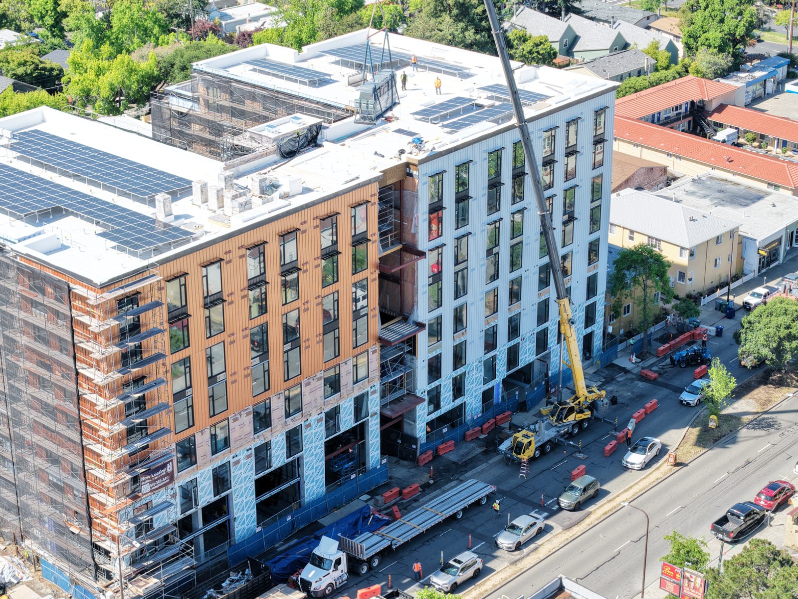
The Challenge of Ground-Level Documentation

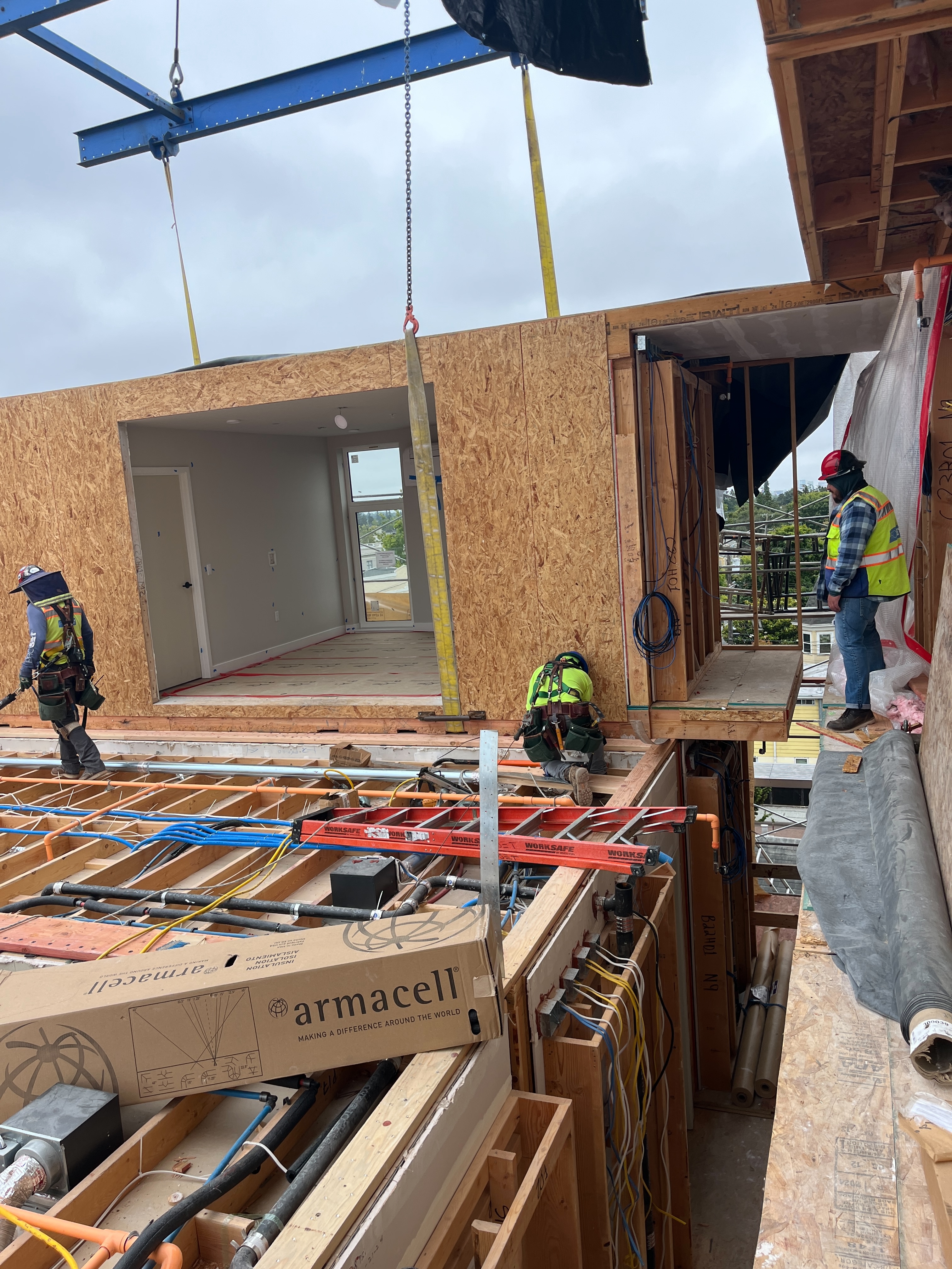
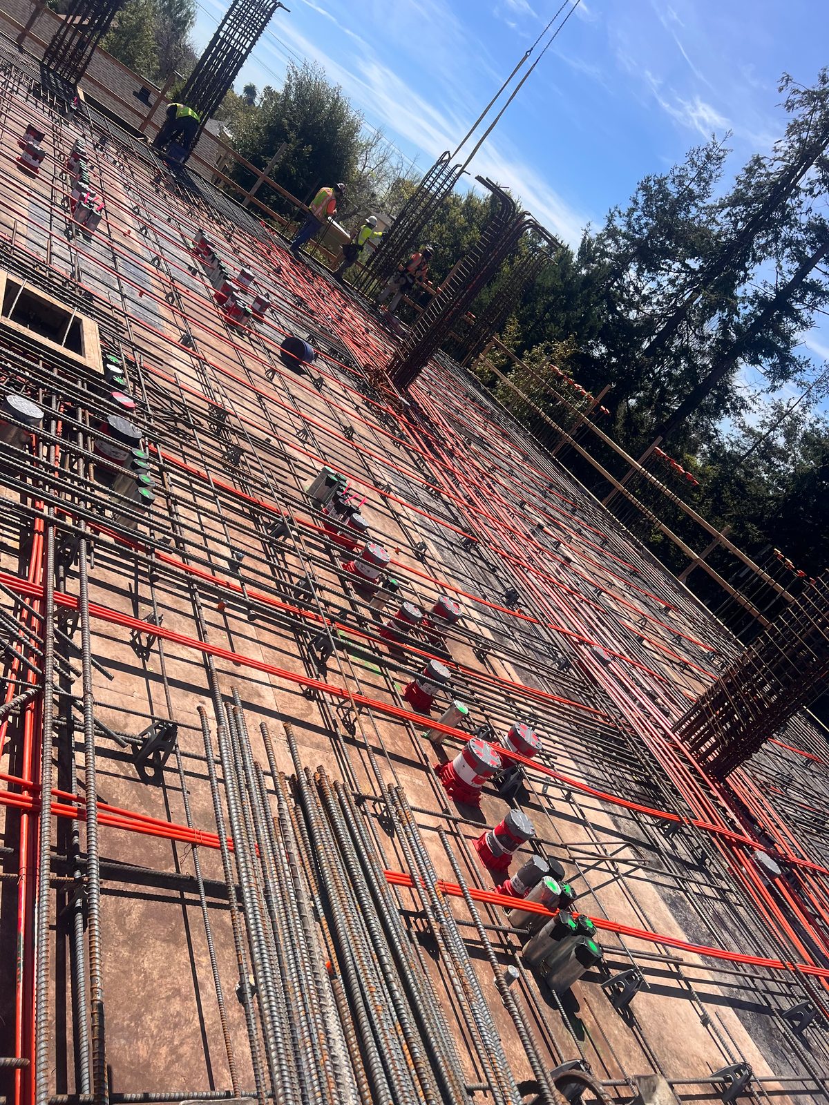
Construction projects are complex, multi-phase operations where progress can be difficult to track from the ground. Traditional documentation methods — walkthroughs, ground-level photography, and written reports — only capture a fraction of what's happening on a job site. They miss the big picture: the spatial relationships between structures, the movement of materials, the overall progress relative to the master plan.

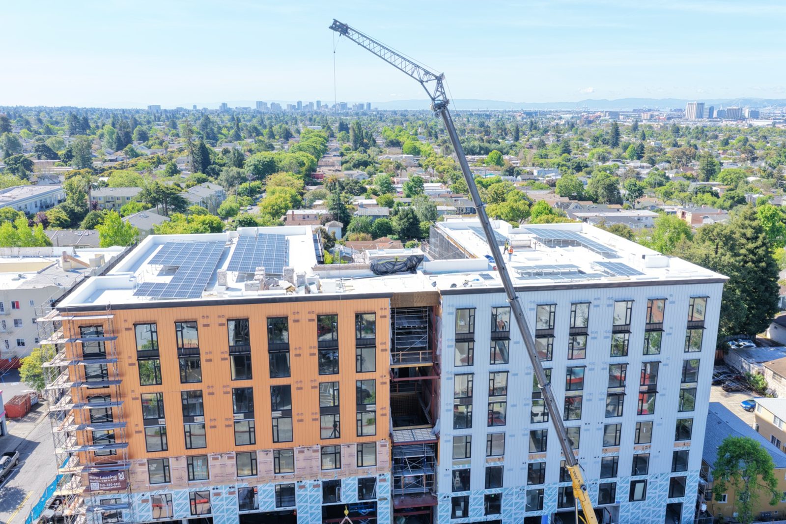
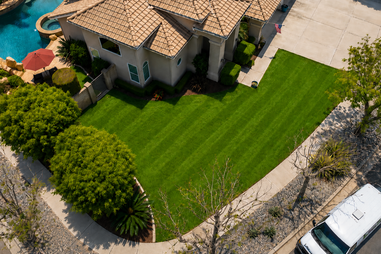
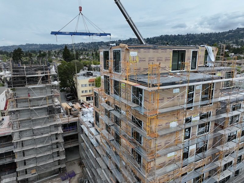
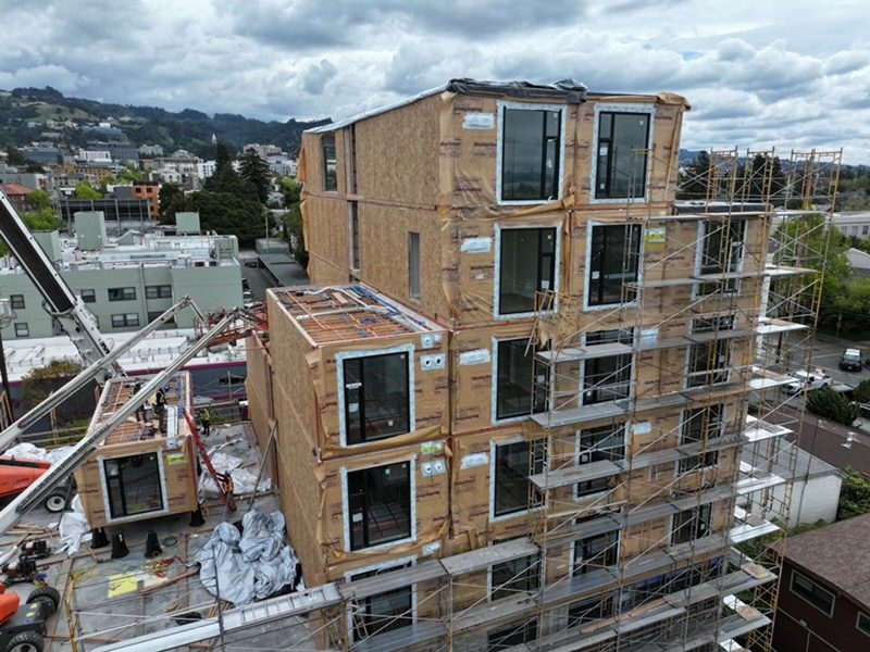
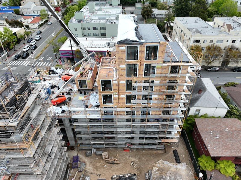
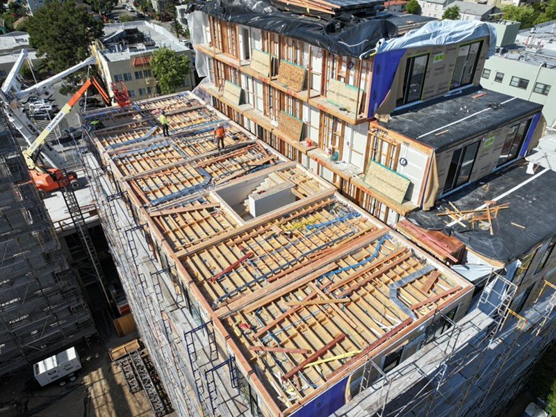
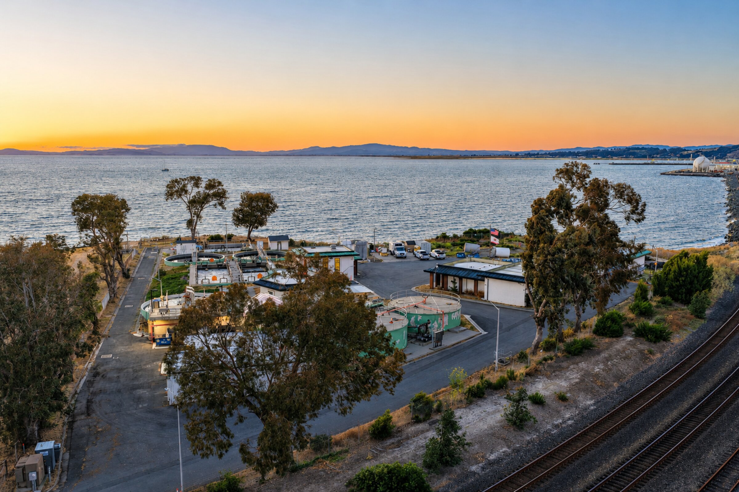
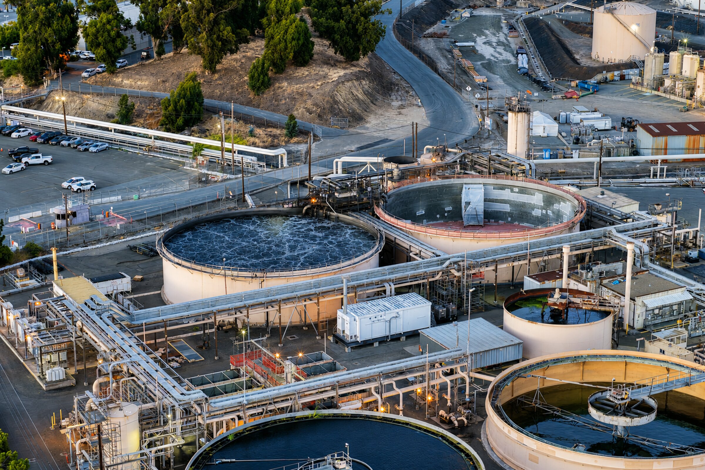
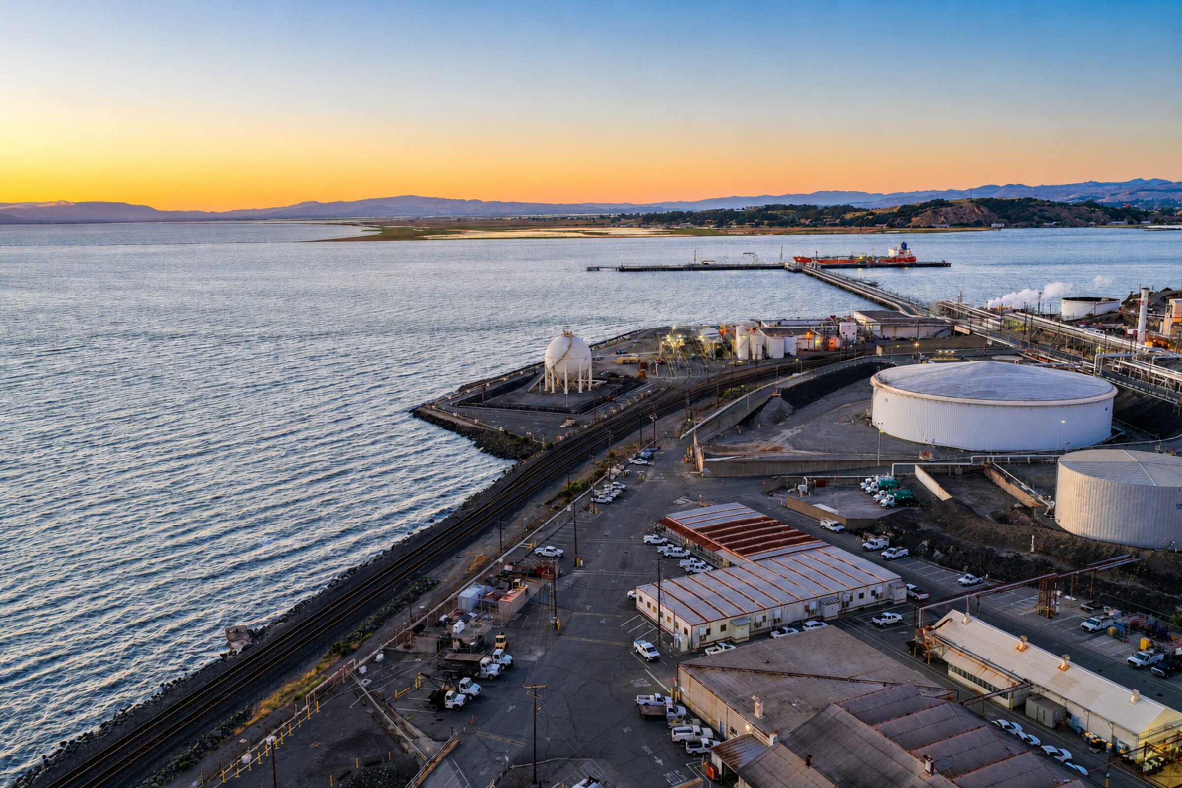
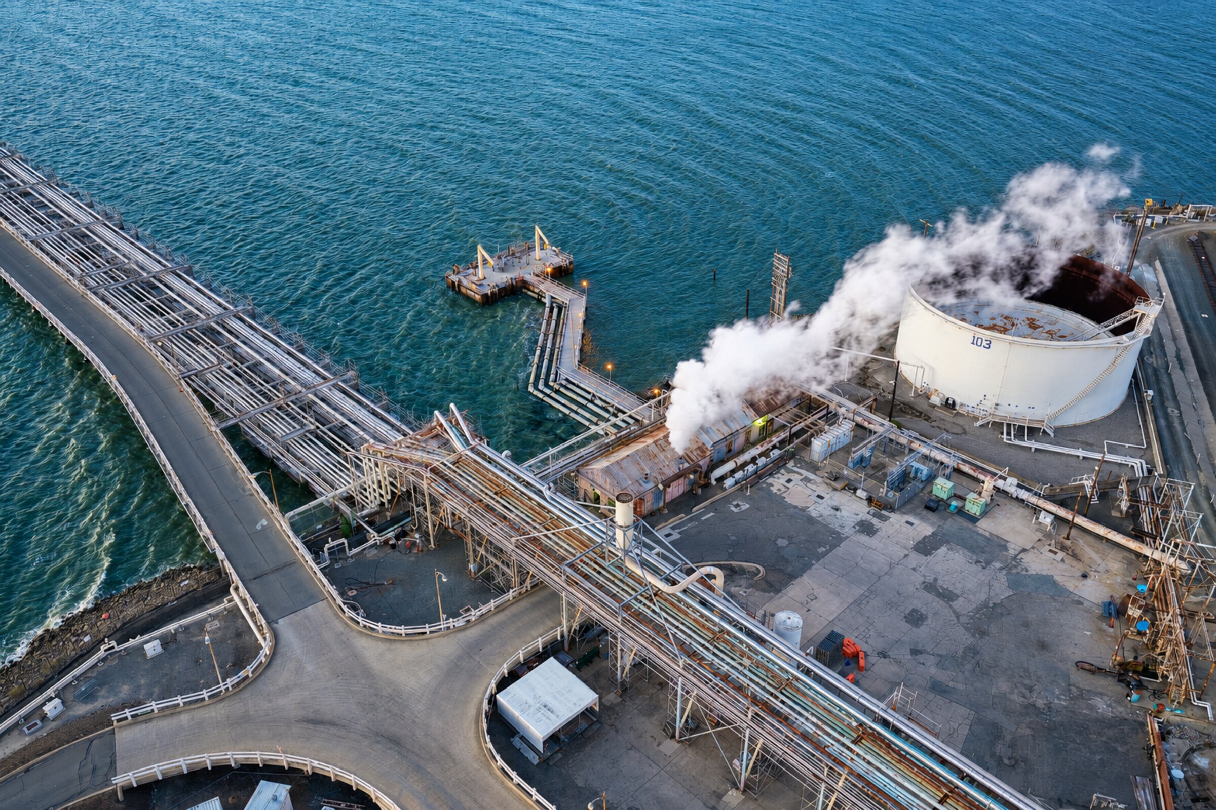
This is where aerial drone photography and videography have become essential tools for modern construction teams. By capturing job sites from above on a recurring schedule, project managers, owners, and stakeholders gain a clear, comprehensive view of progress that ground-level methods simply cannot provide.

How Drone Progress Updates Work

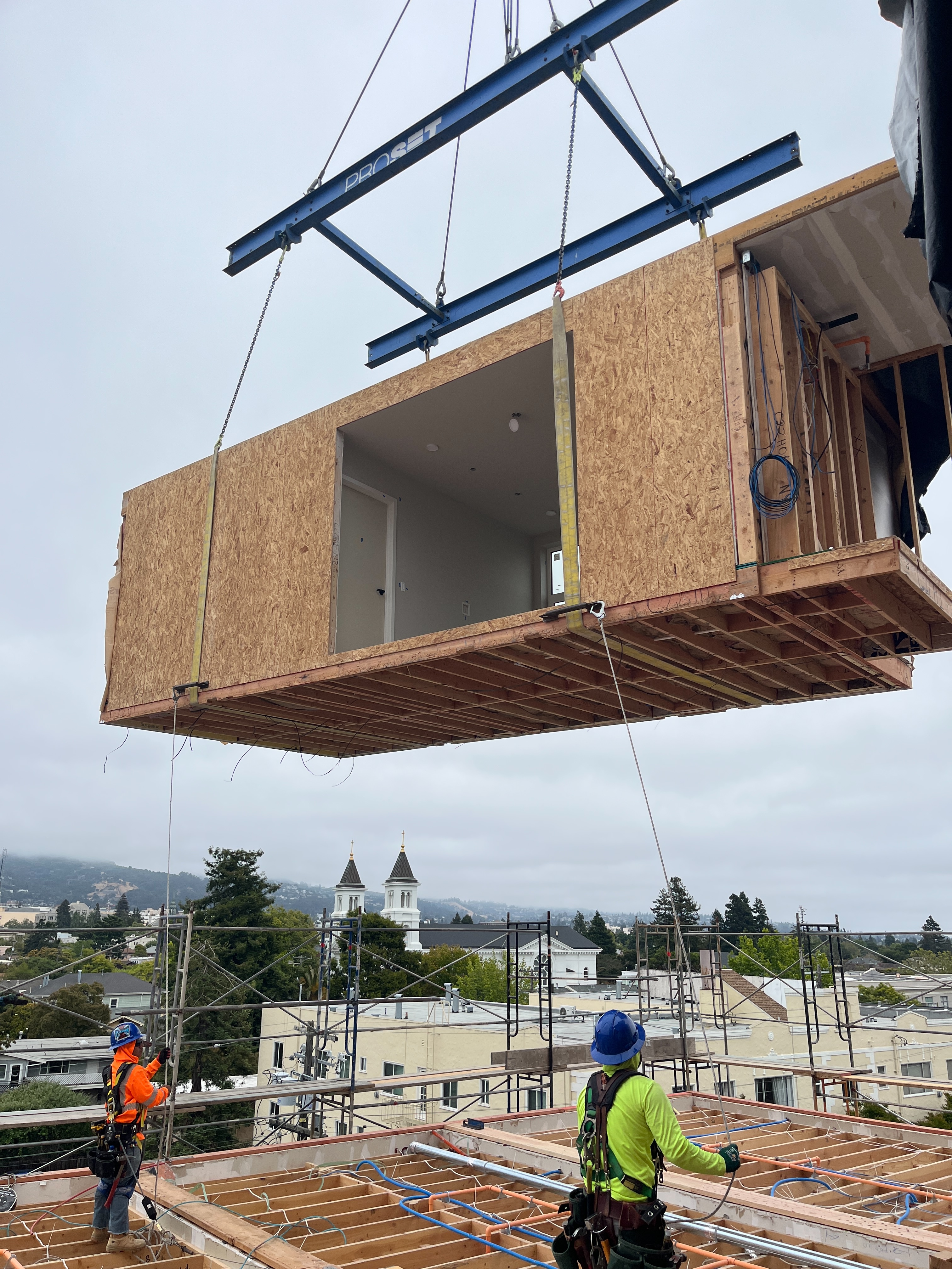
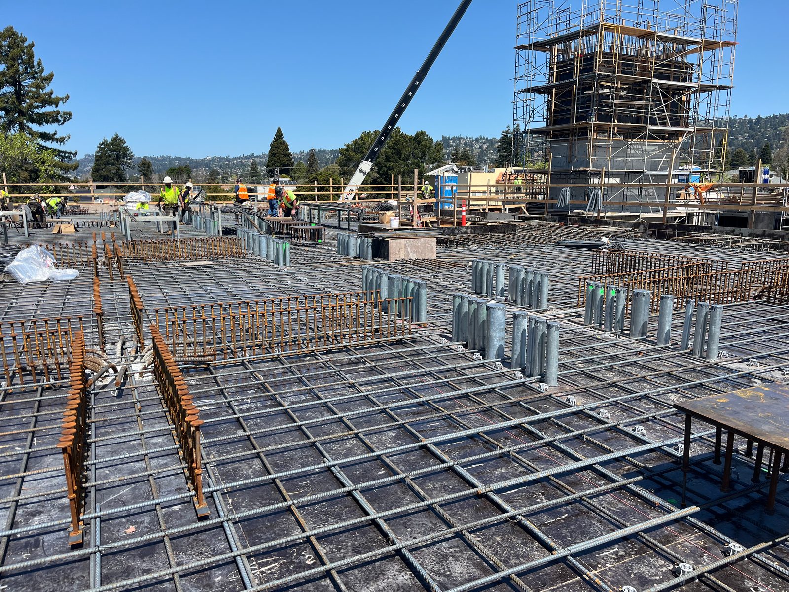
A typical construction progress shoot involves a certified drone pilot visiting the job site at regular intervals — weekly, biweekly, or monthly — to capture a consistent set of aerial images and video. The pilot follows a pre-planned flight path that covers the entire site from multiple angles and altitudes, ensuring consistent framing for easy comparison over time.

Deliverables typically include:

  • High-resolution overhead and angled photographs
  • Cinematic video flyovers showing the full site context
  • Side-by-side comparison images showing progress between visits
  • Orthomosaic maps for detailed site measurement and planning

Benefits for Project Stakeholders

For project owners and investors, drone updates provide visual proof of progress without requiring site visits. This is especially valuable for remote stakeholders or multi-site portfolios where traveling to every location isn't practical.

For general contractors, aerial documentation helps track subcontractor work, verify milestones, and identify potential issues — like drainage problems or staging conflicts — before they become costly delays.

For architects and engineers, overhead views provide a reality check against plans and renderings, helping ensure the built environment matches the design intent.

Real Results on Real Projects

Construction teams that implement regular drone documentation consistently report improved communication, fewer disputes about progress, and better decision-making. When every stakeholder can see exactly what's happening on site — clearly, consistently, and from the best possible vantage point — projects run more smoothly.

Whether you're building a single commercial structure or managing a multi-phase development, aerial progress updates give you the visibility you need to keep projects on track and stakeholders aligned.

Ready to Document Your Next Project?

SkyLens provides recurring aerial documentation packages for construction teams across the U.S. Tell us about your project and we'll build a capture schedule that fits your timeline.

BOOK A PROGRESS SHOOT ← BACK TO BLOG
REAL ESTATE

How Aerial Photography Helps Properties Stand Out

Luxury home aerial photography

First Impressions Start From Above

In today's competitive real estate market, listings with aerial photography receive significantly more engagement than those relying solely on ground-level images. Buyers browse dozens — sometimes hundreds — of listings before scheduling a showing, and properties with drone photos consistently capture more attention, more clicks, and more inquiries.

The reason is simple: aerial photography shows what ground-level photos cannot. The relationship of the home to its surroundings, the size and layout of the lot, nearby amenities, water features, views, and the overall character of the neighborhood. These are the details that help a buyer imagine living there before they ever step through the front door.

What Aerial Photography Reveals

A well-planned aerial shoot captures the property from multiple perspectives that tell a complete visual story:

  • Bird's-eye overhead shots show lot size, landscaping, driveway layout, and outdoor spaces in proper proportion
  • Angled approach shots highlight the home's architecture, roofline, and curb appeal from a dramatic perspective
  • Wide contextual views reveal the neighborhood, nearby parks, waterfronts, and mountain or city views
  • Twilight aerials showcase lighting, ambiance, and pool areas at golden hour for maximum visual impact

The Competitive Advantage

For luxury and high-end properties, aerial photography is no longer optional — it's expected. Buyers in the luxury market are accustomed to cinematic presentations, and listings without aerial content can feel incomplete or underwhelming by comparison.

But aerial photography isn't just for luxury listings. Even mid-range properties benefit from showing off large yards, corner lot positioning, proximity to schools or shopping, and waterfront or mountain views. Any property with a story to tell about its location will benefit from the perspective that only a drone can provide.

Working With Your Listing Agent

The best results come from coordination between the listing agent and the drone pilot. A quick conversation about the property's selling points — the renovated pool area, the proximity to the lake, the expansive backyard — ensures the pilot captures exactly the right angles and compositions to highlight what makes the property special.

Elevate Your Next Listing

SkyLens works with agents and brokerages across California and nationwide to deliver professional aerial photography that helps properties sell faster and at higher prices.

REQUEST A QUOTE ← BACK TO BLOG
MARKETING

Using Drone Footage in Corporate Marketing Campaigns

Aerial cityscape for corporate marketing

Why Aerial Footage Changes the Game

Corporate marketing teams are always looking for content that sets their brand apart. Aerial drone footage offers something that traditional video production often misses: scale, cinematic quality, and a perspective that instantly communicates ambition and professionalism.

Whether it's a sweeping flyover of a company headquarters, a dramatic reveal of a new development, or a high-energy montage for a product launch, drone footage adds a layer of production value that resonates with audiences and elevates brand perception.

Where Drone Footage Fits in Your Marketing

Modern marketing campaigns use content across dozens of channels and formats. Aerial footage is remarkably versatile — a single drone shoot can produce assets for:

  • Website hero videos — Autoplay background footage that immediately sets the tone for your brand
  • Social media content — Eye-catching clips optimized for Instagram Reels, LinkedIn, and YouTube
  • Corporate presentations — Professional B-roll for investor decks, board presentations, and company all-hands
  • Event coverage — Capturing the scale of conferences, grand openings, and corporate events
  • Brand sizzle reels — Showcasing facilities, operations, and team culture from a cinematic perspective

Planning a Drone Shoot for Marketing

The most effective corporate drone shoots start with a clear creative brief. Before the pilot arrives, the marketing team should outline the key messages, target audience, and intended usage of the footage. This allows the pilot to plan flight paths, compositions, and timing (sunrise, golden hour, or twilight) that align with the brand's visual identity.

For companies with multiple locations, a multi-site shoot schedule can be planned to capture all facilities efficiently, providing a consistent visual library for ongoing content needs.

The ROI of Aerial Content

High-quality aerial footage has a long shelf life. A single well-planned shoot can provide content that marketing teams use for months or even years across campaigns, seasons, and platforms. Compared to the cost of traditional helicopter footage or CGI alternatives, drone video is remarkably cost-effective while delivering equally impressive results.

Elevate Your Brand's Visual Story

SkyLens works with marketing teams and agencies to produce professional aerial content that drives engagement and builds brand authority.

START YOUR PROJECT ← BACK TO BLOG
PLANNING

What to Expect When Booking a Commercial Drone Shoot

Drone flying over scenic landscape

Your First Drone Shoot: Step by Step

Booking a commercial drone shoot for the first time can feel unfamiliar. How does scheduling work? What about permits? Who plans the shots? How long does editing take? This guide walks you through the entire process from initial inquiry to final delivery, so you know exactly what to expect.

Step 1: Initial Consultation

Every project starts with a conversation. You'll discuss the location, the purpose of the shoot (marketing, documentation, inspection, listing), the types of deliverables you need (photos, video, or both), and your timeline. This helps the pilot understand your goals and plan accordingly.

During this phase, the pilot will also assess any potential airspace restrictions or permit requirements for your location. Many urban areas require FAA authorization (LAANC), and certain locations near airports, stadiums, or government facilities have additional rules.

Step 2: Shot List and Flight Planning

Once the scope is defined, the pilot creates a shot list tailored to your needs. This includes specific compositions, altitudes, angles, and any special requests. For recurring projects (like construction progress), a standardized flight path is established to ensure consistent framing over time.

Flight planning also accounts for weather, lighting conditions, and time of day. Golden hour (the hour after sunrise or before sunset) produces the most dramatic and visually appealing footage, while midday shoots work well for documentation and inspection purposes.

Step 3: The Shoot Day

On shoot day, the pilot arrives early to set up equipment and perform pre-flight safety checks. A typical commercial shoot takes 1 to 3 hours depending on the scope, number of compositions, and whether both photo and video are being captured.

You're welcome to be on-site during the shoot. Many clients appreciate seeing the live feed from the drone camera to confirm that the right angles and areas are being captured. This real-time collaboration ensures you get exactly the content you need.

Step 4: Editing and Delivery

After the shoot, the pilot processes and edits the raw footage. For photography, this includes color correction, exposure balancing, lens correction, and final export at full resolution. For video, it includes color grading, stabilization, music selection (if requested), and export in multiple formats optimized for web, social media, and presentations.

Standard turnaround is 3 to 7 business days, with rush delivery available for time-sensitive projects. Deliverables are shared via a secure download link or cloud folder.

Step 5: Usage and Licensing

All commercial drone content from SkyLens comes with full commercial usage rights. You can use the photos and videos across your website, social media, print materials, presentations, and listing platforms without additional licensing fees.

Ready to Book Your First Shoot?

Tell us about your project and we'll handle all the planning, permits, and production. From initial consultation to final delivery, we make the process simple and professional.

GET STARTED ← BACK TO BLOG
GUIDE

Aerial Video vs. Aerial Photography: Which One Do You Need?

Dramatic aerial sunset photography

Two Powerful Tools, Different Strengths

When planning an aerial project, one of the first decisions you'll make is whether you need photography, videography, or both. While they're often captured during the same flight, each format serves different purposes and excels in different contexts. Understanding the strengths of each will help you invest in the right deliverables for your project.

When Aerial Photography Is the Right Choice

Aerial photography is ideal when you need high-resolution, detailed images for specific applications. Photos are easier to use across platforms, load faster on websites, and work well in print materials where resolution and clarity matter most.

Best for:

  • Real estate listings and MLS platforms
  • Construction progress documentation and reports
  • Insurance inspections and claims documentation
  • Print marketing materials, brochures, and signage
  • Website hero images and landing pages
  • Environmental surveys and mapping

When Aerial Video Is the Right Choice

Aerial video shines when you need to convey motion, scale, and emotion. A well-produced drone video can tell a story in ways that a single image cannot — revealing a property as a buyer approaches, showing the flow of a facility, or capturing the energy of an event from above.

Best for:

  • Website background and hero videos
  • Social media content (Reels, Shorts, Stories)
  • Brand sizzle reels and company overview videos
  • Event coverage and highlight reels
  • Property tours with cinematic reveal sequences
  • Corporate presentations and investor materials

Why Not Both?

In many cases, the best approach is to capture both during the same shoot. Modern drone cameras can shoot high-resolution still photos and 4K video on the same flight, making it efficient and cost-effective to get both formats. This gives you a complete content library that covers print, web, social media, and presentation needs.

At SkyLens, most of our clients opt for a combined photo and video package. It maximizes the value of a single shoot day and ensures you have versatile content for every channel and use case.

Not Sure What You Need?

Tell us about your project and goals, and we'll recommend the right combination of aerial photos and video to get the results you're looking for.

LET'S TALK ← BACK TO BLOG
STILL PHOTOGRAPHY

Why Professional Still Photography Still Matters in a Drone-First World

Professional still photography at a wedding ceremony

The Ground-Level Perspective

Aerial photography captures the big picture — the sweeping landscapes, the full scope of a property, the scale of a construction site. But some of the most powerful images in any project are taken from the ground. The handshake at a closing, the first dance at a wedding, the detail of a finished countertop, the expression on a client's face when they see the final result.

Professional still photography captures what drones cannot: intimacy, detail, and human connection. That's why SkyLens offers ground-level still photography alongside our aerial services — so clients get complete visual coverage of their most important moments and projects.

When Still Photography Is Essential

While aerial content is powerful for establishing scale and context, still photography excels in situations where detail, emotion, and proximity matter most:

  • Weddings and engagements — Capturing the ceremony, the details, and the candid moments that make the day unforgettable
  • Corporate events and galas — Professional documentation of keynotes, networking, venue décor, and brand activations
  • Special celebrations — Birthdays, anniversaries, and milestone events preserved with intention and artistry
  • Real estate interiors — Room-by-room photography that complements aerial exterior shots for complete listing packages
  • Construction close-ups — Detail shots of finishes, materials, and craftsmanship that overhead views miss

Combining Aerial and Ground Photography

The most compelling visual packages combine both perspectives. A real estate listing with aerial views of the neighborhood and professional interior photography tells a complete story. A wedding with drone footage of the venue and intimate ground-level portraits gives the couple a full record of their day.

When you book a combined aerial and still photography package with SkyLens, both components are planned together. The pilot and photographer coordinate timing, angles, and coverage to ensure every important moment and perspective is captured — with no gaps and no redundancy.

What to Expect From a Still Photography Session

Our still photography process follows the same professional standards as our aerial work. Before the shoot, we discuss your goals, must-have shots, and any specific style preferences. On the day, our photographers work unobtrusively — especially at events — to capture authentic moments without disrupting the flow.

Deliverables include professionally edited, high-resolution images delivered within 5 to 10 business days. All images come with full commercial or personal usage rights, ready for print, web, social media, or any other application.

Quality That Matches Our Aerial Work

Whether we're 400 feet in the air or standing right beside you, the standard is the same: clean composition, accurate color, professional editing, and images that serve your goals. Our still photography isn't an afterthought — it's a core part of our service offering, delivered with the same attention to detail that our aerial clients depend on.

Book a Still Photography Session

Whether it's a wedding, corporate event, celebration, or a combined aerial and ground package, SkyLens delivers professional photography you can trust.

BOOK A SESSION ← BACK TO BLOG
SHOWREEL

SkyLens Aerial Showreel

Cinematic aerial photography and videography from coast to coast.

Lake Tahoe aerial Luxury estate Construction site City skyline Waterfront Solar array Lake property Modern home Construction crane Cityscape Residential Wind farm Lake estate Aerial photography Lake Tahoe aerial Luxury estate Construction site City skyline Waterfront Solar array Lake property Modern home Construction crane Cityscape Residential Wind farm Lake estate Aerial photography

Corporate & Cityscape

Cinematic urban aerials for brand, marketing, and corporate media.

Landscapes & Nature

Breathtaking natural landscapes from mountain peaks to ocean shorelines.

VIDEO SHOWCASE

Featured Drone Footage

FEATURED

Coastal Flyover

Cinematic aerial footage showcasing waterfront properties and natural landscapes from above.

REAL ESTATE

Real Estate Tour

Professional aerial tour of luxury properties highlighting architecture, grounds, and surrounding areas.

CONSTRUCTION

Construction Progress

Recurring aerial documentation tracking construction milestones and site development over time.

500+Projects Completed
50+Cities Covered
10K+Photos Delivered
100%Client Satisfaction
READY TO ELEVATE YOUR PROJECT?

Let's Create Something Extraordinary

From real estate to construction, corporate to landscape — our aerial photography and videography delivers visuals that make an impact.

BOOK A SHOOT
CONTACT

Book a Shoot

Fill out the form below and we'll get back to you within 24 hours to discuss your project.

Let’s capture your project.

Phone:
510-507-4904

Email:
info@slapdrone.com

Location:
Bay Area, California
Serving Nationwide

Instagram:
@skylensap

1 / 1